
Sacandaga Blockhouse
Full History >>
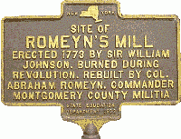
Description: Sacandaga Blockhouse: 1777, Fulton County, Mayfield. Sometimes referred to as Mayfield Fort it was built 20 miles north of the Mohawk, just off Van Den Burgh Road close to the southwestern shore of present day man-made Sacandaga Lake (Sacandaga River). Accounts vary and it was either attacked and destroyed in June 1778 or attacked and not destroyed in April 1780. Shown is the only historical marker found in Mayfield.
[Description of image]
Site of Romeyn's Mill
Erected 1773 by Sir William
Johnson. Burned during
Revolution. Rebuilt by Col.
Abraham Romeyn, commander
Montgomery County Militia.
County: Fulton County
City, State: Mayfield, New York
Image:
Sacketts Harbor Forts
Full History >>
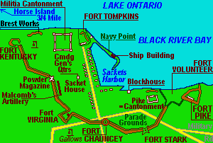
Description: Sacketts Harbor Forts: 1812-1815, Jefferson County, Sacketts Harbor. Hastily prepared earthen works named Fort Volunteer were established at the start of the War of 1812 to defend the Northeast end of Sackets Harbor (East side of Black River Bay). A new set of breastworks and a blockhouse named Fort Pike was constructed adjacent followed by a string of fortifications defended the land side approach named Forts Kentucky, Virginia, Chauncey, and Stark. Also Fort Tompkins was on Lake Ontario at the lands end of Navy Point. Later, Volunteer and Pike became the nucleus of Madison Barracks. Proposed to become a village park in the near future.
County: Jefferson County
City, State: Sacketts Harbor, New York
Image:
See Also:
Related Links:
Sag Harbor Fort
Full History >>
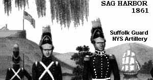
Description: Sag Harbor Fort: 1776, Suffolk County, Sag Harbor. The British occupied Sag Harbor in 1776 (it was, next to NYC, the most important port in the province). The British established a major depot and arsenal for supplies on Long Island. An American raid May 1777 destroyed the supplies and captured 90 prisoners. No mention is made as to fortifications. 1813 garrison of 3,000 American soldiers, battle of Sag Harbor. Remained in use as an installation into the 1860s ? (per a drawing of the Suffolk Guard which existed in 1839).
[Description of image]
Sag Harbor, 1861
Suffolk Guard
NYS Artillery
County: Suffolk County
City, State: Sag Harbor, New York
Image:
SAGE (Semiautomatic Ground Environment System)
Full History >>
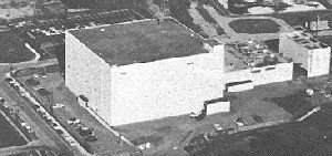
Description: Sage(Semiautomatic Ground Environment System). : 1957-1980? An Air Defense electronic air-surveillance and weapons control system. Data-processing center evaluated and developed information into an air situation and issued weapons guidance orders. Initially it provided guidance for manned interceptors, and was later modified to work with the BOMARC missle. The computer had 50 display consoles for a football field sized computer with 60,000 vacume tubes (now about 256k). The SAGE Direction Center building contained power generation and computing equipment, operational area (over 100 staff), office and maintenance facilities. There were about thirty centers throughout the US and each center was responsible for a sector. The Direction Center for the Boston Sector (Maine to NYC) was at Stewart AFB (BOMARC at Suffolk) and the ___ Sector (Maine to ?Chicago) was at Hancock Field AFB (BOMARC at Niagara Falls).
County: Orange County
City, State: Newburgh, New York
Image:
Sailor's Battery
Full History >>
Description: Sailor's Battery: 1812-17, Erie County, Buffalo. South side of Conjaquadie's Creek near its mouth with the Niagara River. A Battery of three 32 pounders. Last in a line of 8 Batteries from the Terrace to the Creek. To the South was Swift's Battery.
County: Erie County
City, State: Buffalo, New York
See Also:
Salem, Fort
Full History >>
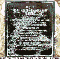
Description: Fort Salem Town of Salem: Washington County, 1777. Also known as White Creek Fort for White Creek and one of the Village's original names. Also referred to as Fort Williams in some accounts, but this likely belonged to another site (see Fort Williams). Also called Number 5. The partially completed New England (Presbyterian) church was converted into a fort by addition of a picket wall, 26 July 1777. The stockade was about 60 feet from the church and constructed from 10 inch diameter 12 to 13 foot sections of an old log meeting house, the balance of the logs went for a blockhouse (see Fort Williams). The area about the fort was also referred to as Fort Edward green. Garrisoned by Cpt. (Col) McCraken's Militia Company (White Creek Militia), of Col. Webster's Regiment. The Militia had left the Town and most citizens had left due to the advance of Bugoyne, when royalists/tories burned the fort between the end of August to 25 September 1777. Plaque reads "Site of The White Creek Fort, Erected as a Presbyterian Church in 1774 and converted to a fort early in the Revolution, Garrisoned by Charlotte County Militia under Command of Col. Joseph McCraken, it was the starting point of many raids on the supply lines of Gen. Burgoyne during the invasion from the North, destroyed by tories and British in 1777."
Thanks to William A. Cormier, Town Historian, for this information, www.sover.net/~salemny/histh1.html
County: Washington County
City, State: Salem, New York
Image:
See Also:
Salonga (Slonga), Fort
Full History >>
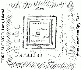
Description: Fort Salonga: 1776-81, Suffolk, Fort Salonga. (Slongo) British earthen fortification (minor redoubt). Destroyed by American raid October 1781. Now on private property, bordering Route 25A east of Bread and Cheese Hollow Road in Fort Salonga.
County: Suffolk County
City, State: Fort Salonga, New York
Image:
Related Links:
Salt Battery
Full History >>
Description: Salt Battery: War of 1812, Niagara County, Village of Youngstown. An impromptu battery to protect the Village docks, constructed of 400 barrels of salt.
County: Niagara County
City, State: Youngstown, New York
Salt Point Blockhouse
Full History >>
Description: Salt Point Blockhouse: 1795, Onondaga County, N. Syracuse. Salt Point bluff is near bridge over Oswego Canal, and Route 81 and Hiawatha Blvd. Blockhouse was 20 foot high building with loopholes, surrounded by a 20 foot palisade. Demolished in 1816.
County: Onondaga County
City, State: Syracuse, New York
Branch:
Sampson Army Airfield
Full History >>
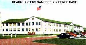
Description: Sampson Army Airfield: The Air Force spent about $6 million on renovations and beginning mid Feb 1951 started traing what would be 16,000 Air Force recruits. The base employed about 700 civilians and had 600 permanent party troops. The Base was closed in June 1955. Starting in 1957 to 1960 the Air Field and some Officer Housing on the lake shore (449 acres) were transferred to the Seneca Army Depot, the hospital, now listed as 1,000-beds was transferred to Willard State Hospital (dated 9 Sep 1958 and filed 24 June 67), and 1265 acres of the Station were sold to NYS for park use 7 June 1960 (two parcels totaling 355 acres were auctioned to private individuals). One of the old rifle ranges is still used by the Town Police.
The Station was used by NYS for use as a temporary college for 15,000 GI Bill students in July 1946. (5 barracks were moved to Hobart in Geneva, 7 were moved to Syracuse University) Sampson College operated from September 1946 to June 1949 and had matriculated 7,500 students of which 950 received two-year degrees.
In March 1950 Sampson was proposed to be a State Park, but by October it was determined that the Air Force wanted it for training. The Center was transferred to the Air Force, for use as an indoctination center similar to Lackland AFB in San Antonio. Willard vacated the hospital area.
Sampson State School. The former hospital area was operated as a State School by Willard. In 1971 the State closed the School due to budget cuts. While empty a fire destroyed most of the main hospital complex. Contaminated by asbestos the site was cleaned and is still owned by the Department of mental Hygiene but remains vacant.
County: Seneca County
City, State: Geneva, New York
Image:
See Also:
Sampson Naval Hospital
Full History >>
Description: Sampson Naval Hospital: The Station included a 1,000-bed hospital, housing for personnel, and a school to train corpsmen. Thirty one-story ward buildings comprised the main hospital with additional special services buildings, quarters for officers and nurses, a recreation building and barracks for corpsmen. (reports vary from a typical 100 bed hospital, constructed as a 1,000-bed hospital and often listed as a 2,500-bed hospital). The 1,000-bed hospital, with about 900 TB patients, transferred to the VA at the close of 1946. This was known as area Q, a 466 acre reservation of 141 buildings. On 1 July 1946 the hospital was closed due to budget cuts. In October 1946 the hospital was transferred to Willard State Hospital.
County: Seneca County
City, State: Sampson, New York
Sampson Naval Training Base
Full History >>
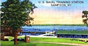
Description: Sampson Naval Training Base: On 13 May 1942 construction was announced for a second military installation in Seneca County, on the east shore of Seneca Lake, close to the Army Ordnance Depot (1941 - later Seneca Army Depot). The Station finally covered 2535 acres and was completed in 270 days at a cost of approximately $56 million. The Station occupied about four and one-half miles of lakefront. About 4-5,000 Navy personnel operated and maintained the Station. A total of 411,429 Naval Recruits were trained there during the three and one-half years of operation. Each station unit, to train 5000 recruits, was developed around a parade ground and drill field of 14 acres, adjoined by a drill hall with a two acre indoor drill area, gymnasium, swimming pool, movable stage and motion picture equipment. Living and administrative areas included a mess hall to serve meals cafeteria style, twenty-two barracks to house 228 men each, two barracks for Chief Petty Officers, two dispensaries, a ship service building for recreation, an administrative building, rifle range, small arms magazine and a large storehouse. Sampson had five such Units (six had been planned). Units were named Dewey, Callighan, Farragut, Gilmore, and Edwards. A central group of buildings provided recreational needs for the Station as a whole and included; a large 2,700 seat auditorium, a reception/visitors building, a 400 seat chapel, a CPO Recreation building, a central administration building, receiving building, post office, brig, disciplinary barracks, and guard barracks. There was also a special group of buildings for trainees awaiting assignment after completion of training. On 15 September 1945 Sampson was opened as a separation center, by the beginning of October, three of the five recruit-training sections were closed, and its training career ended 1 November. The Separation Center planned to discharge 100 men daily but was averaging 300 to 400 daily. By the end of October 13,000 had been processed. The 65,00th discharge was on 25 March 1946. The last discharge was early April 46 and the Center was closed.
County: Seneca County
City, State: Geneva, New York
Image:
See Also:
Sanborn (NF-16) Nike Base
Full History >>
Description: Sanborn (NF-16) Nike Base: Mid 1950s-Mid 1960s, Integrated Fire Control Area for Nike-Ajax Missiles, associated launcher area was Cambria
See Nike for more information.
County: Niagara County
City, State: Niagara Falls, New York
Saraghtoga, Fort
Full History >>
Description: Fort Saraghtoga: 1704, Washington County, Town of Easton. 150 feet long by 140 feet wide to house 450 troops. Had six 12 pounders and six 18 pounders. Located on East side of Hudson River opposite Fort Saratoga. Demolished in 1713.
County: Washington County
City, State: Easton, New York
See Also:
Saratoga Battle Forts
Full History >>
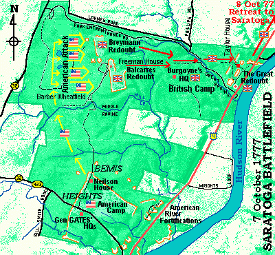
Description: Saratoga Battle Forts: For details see Fort Neilson, Balcarres Redoubt, Breymann Redoubt, and Great Redoubt.
For more information see: www.cyhaus.com/usroute4/ (link opens new window)
County: Saratoga County
City, State: Saratoga, New York
Image:
Saratoga, Fort
Full History >>
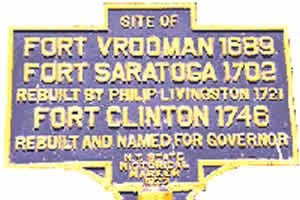
Description: Fort Saratoga: 1702, Saratoga County, Schuylerville. Built on the Hudson River South of Fish Kill (Creek) South of present day Schuylerville, by Col. Schuyler during the Nicholson Expedition as a supply post. Site of previous blockhouse (Fort Vrooman 1689) for the Winthrop Expedition. A stockaded fort was proposed in 1702 to be manned by a Lt. and 30 men. Rebuilt 1721 by Phillip Livingston. Destroyed Nov 1744 by 400 French and 200 Indians that plundered down to outskirts of Albany. Rebuilt in 1746 as Fort Clinton (1).
[Description of image]
Site of
Fort Vrooman 1689,
Fort Saratoga 1702
rebuilt by Philip Livingston 1721,
Fort Clinton 1746
rebuilt and named for Govenor
County: Saratoga County
City, State: Schuylerville, New York
Image:
Schenectady Service Force Depot
Full History >>
Description: 1918, Schenectady County, Rotterdam. The depot was constructed in 1918 and served the Army during the later months of WW1. After the war it was used as a supply depot for 55 Civilian Conservation Corps Camps. In 1941 the depot was expanded and renamed Service Forces Depot. Mostly the depot shipped motor vehicles to the Port of New York. At its peak it employed 4000 people. Late in WW2 it was renamed again to General Depot. From January 1948 to March 1949 it was a processing station for war dead. In the post war years it was again renamed Army Depot. Expanded again during the Korean War. The depot continued operations for a number of years after Korea and then was closed.
County: Schenectady County
City, State: Rotterdam, New York
Schenectady Stockade
Full History >>
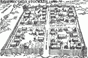
Description: Schenectady Stockade (1): (Schenectida) 1672 received patent. The village was divided into four blocks, or squares, and these were subdivided into house-lots. The entire area of the village was enclosed and fortified with stockades, or palisades. It was patented as a township with certain municipal rights in 1684. At various times in its early history, Schenectady suffered from the attacks of the French and the Indians. The most memorable of these attacks known as "The Massacre of Schenectady". was in February, 1690. Schenectady is said to have had at this time about 80 houses and 400 inhabitants, of which 60 were killed, 27 made prisoners, and the village burned. The village was protected by palisades. There were two gates, one at the north end of Church street, the other at the south end, opening out to the Albany road. There was, also, near what is now the corner of Washington and Front streets, a fort garrisoned by 24 men.
Schenectady Stockade (2):1690, Schenectady County, Schenectady. After the destruction of this stockade, another one was built immediately that served until a new fort was built about 1705 at the opposite corner where now is the junction of Front, Ferry, and Green streets, named Queen's Fort in 1705 and also known as Royal Fort.
Schenectady Stockade (3):1735, Schenectady County, Schenectady. A new stockade was erected in 1735. A parallelogram from present N. Street near the river, south to the vicinity of Schenectady County Community College, east along State Street to Rail Road, then north from Wall Street to the start. A new fort, also known as Corlear's Fort and in 1754 known as Fort Cosby was built of heavy wooden timbers set on a stone wall. This was almost 12 feet high and 100 feet to a side. In 1776 referred to as Fort Schenectady, with Continental Army Troop Barracks. Later maps showed a stockade with numerous blockhouses in addition to the fort. The third stockade and fort were demolished about 1783.
County: Schenectady County
City, State: Schenectady, New York
Image:
See Also:
Schlosser, Fort
Full History >>
Description: Fort Schlosser: 1760, Niagara County, Niagara Falls. Built 40 rods further upstream from the site the French Fort Little Niagara or Fort du Portage (1750-9) at the head of the Niagara Falls Rapids and south (upper) end of the land route from Fort Niagara. The new fortifications were a ditched square earthworks fort with four bastions. The chimney from the burned French fort was used for the new barracks and mess house. The British also established a shipyard on Navy Island in the river opposite the Fort. The portage route was attacked frequently and in September 1763 was the "Devils Hole Massacre". Based on that 11 (or 5 by another account) blockhouses were constructed on the route for shelter in 1764. It remained occupied by the British during the Revolutionary War and American operations never got to that area. Vacated in 1796. Garrisoned by American troops in the War of 1812 it was captured in December 1813 and burned, although another account says it was maintained until 1857 when it burned. The stone chimney was still there in 1980.
County: Niagara County
City, State: Niagara Falls, New York
See Also:
Schroeppel Fort
Full History >>
Description: Town of Schroeppel Fort: 1758-59, Oswego County, Town of Schroeppel. A stockaded fort about 60 feet square with three storehouses. Site on NY Route 57 at Three Rivers.
County: Oswego Cunty
City, State: Schroeppel, New York
Schuyler, Fort
Full History >>
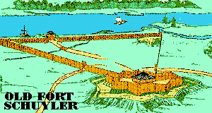
Description: Fort Schuyler (1): 1709, Washington County, Village of Fort Ann. Built by Col. Nicholson in his advance against the French (Nicholson Expedition), in The Queen Anne's War, named in honor of Col. Peter Schuyler, destroyed in retreat to Albany. Rebuilt in 1711 as Queen's Fort, renamed Fort Anne.
Fort Schuyler (2): 1775, Oneida County, Utica. Revolutionary War, not to be confused with Fort Stanwix in Rome.
Fort Schuyler (3): 1776, Oneida County, Rome. Name also used by Americans for Fort Stanwix during the Revolutionary War.
County: 1) Washington County, 2) Oneida County, 3) Oneida County, 4) Bronx County
City, State: 1) Fort Ann, New York, 2) Utica, New York, 3) Rome, New York, 4) Throgs Neck, New York
Image:
Related Links:
Schuyler's Supply Depot
Full History >>
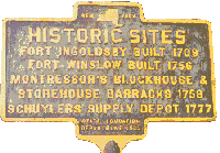
Description: Schuyler's Supply Depot: 1777, Saratoga County, Stillwater. Built on or near previous forts and barracks (Ingoldsby 1709, Winslow 1756, Montressor 1758), General Phillip Schuyler built fortified supply depot in preparation for Burgoyne's advance.
[Description of image]
Historic Sites
Fort Ingoldsby built 1709
Fort Winslow built 1756
Montressor's Blockhouse &
Storehouse Barracks 1758
Schuylers Supply Depot 1777
County: Saratoga County
City, State: Stillwater, New York
Image:
Scotia Naval Supply Depot
Full History >>
Description: Scotia Naval Supply Depot: 1942, Schenectady County, Scotia. The depot was built in 1942-43 as a storage and supply depot for naval forces along the Atlantic coast and Europe. Mostly stored large items such as boilers, turbines and reduction gears. Home of the Navy's Landing Craft Maintenance and Battle Damage Program and the Navy's Automotive and Handling Equipment Spare Parts Program. Employment peaked in 1945 at 2342. In 1947 five storage facilities were improved as permanent storage facilities for large machine tools. During the Korean War home for the Navy's Specifications, Forms and Publication Center. Recently most of the depot has closed and reverted to commercial use. A small Naval Reserve and Surplus Property Operation remains.
County: Schenectady County
City, State: Scotia, New York
Scott, Camp Winfield
Full History >>
Description: Camp Winfield Scott: 1860, Suffolk County, Long Island. Near what later was Camp Black.
County: Suffolk County
City, State: Long Island, New York
Branch:
Scott, Fort
Full History >>
Description: Fort Scott: 1814, Clinton County, Plattsburgh. One of three redoubts between Saranac River and Lake on Platt's Point, 8 cannon no buildings. Part of Land Battle in Battle of Plattsburgh, War of 1812. See Plattsburgh Battle Forts for story and map.
County: Clinton County
City, State: Plattsburgh, New York
Branch:
See Also:
Seneca Army Depot
Full History >>
Description: Senaca Army Depot: 1941, Seneca County, Seneca Falls. Near Sampson Naval Training Center (1942) (now a State Park, except for Officer Row) and the Sampson Army Airfield (1950 former SNTC) (airstrip part of the Depot), and the Naval Hospital (now state property). Major ammunition depot for the East Coast. Started in 1941 as a 11,500 acre ammunition dump with an aviation runway. The North Depot Activity was developed in 1956 and included storage of special weapons for the Griffiss AFB. The special weapons support (north) post was merged with the Depot in 1961 and was vacated upon closure of Griffiss in 1993. Two large GSA warehouses were built in 1953 and 54. The depot is in closure operations since listed to be closed in 1995. Future disposition unknown.
County: Seneca County
City, State: Seneca Falls, New York
Setauket, Fort
Full History >>
Description: Fort Setauket: 1777, Suffolk County, Setauket. Occupied by a Tory Battalion the Presbyterian Church on Strong's Neck Road was fortified. The post was enclosed at a distance of 30 feet with 6 foot high earthworks topped with a palisade of 6 foot pickets. The parapet included interior "steps" for firing positions. American attacks repulsed in August 1777 and December 1777. Abandoned in early 1778. Local citizens restored the church (which later burned and was rebuilt) and removed the earthworks.
County: Suffolk County
City, State: Setauket, New York
Shanks, Camp
Full History >>
Description: Camp Shanks: Jun 1943-July 1946, Rockland County, Orangeburg. Camp Shanks was a large staging area for troops going overseas through the New York ports of embarkation. 1944 had Italian Service Units. Hospital was used for debarkation hospital at the end of the war. After war, used as a staging area for German POW repatriation. Closed and sold after the war.
County: Rockland County
City, State: Orangeburg, New York
Skenesborough, Fort
Full History >>
Description: Fort Skenesborough: 1759, 1775-77, 1812, Washington County, Whitehall. The first structure here was a blockhouse in 1759 with a barracks on a hill to the west of Wood Creek, which still existed in 1775. The site is between the Presbyterian Church and the Masonic Temple. At the start of the Revolutionary War the Americans took Skenesborough (Philip Skene was a Loyalist) and built new fortifications strating in October 1776. This site was also the shipyards for General Arnold's Lake Champlain fleet. Built very near the 1759 site was a barracks and a fortified stockade described as an irregular polygon. Retreating before Burgoyne in July 1777 the Americans attempted to burn the fort. The British repaired and garrisoned the fort along with fortifying Skene's stone barn, for three weeks before continuing on to Saratoga. During the War of 1812 a new blockhouse was constructed within the ruins of the old fort to protect the shipyards.
County: Washington County
City, State: Whitehall, New York
Slocum, Fort
Full History >>
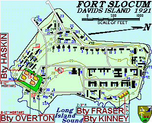
Description: Fort Slocum: 1861, Davids Island (80 acres), near Rye, NY. Named for Major General Henry W. Slocum, hero of Antietam and Chancellorsville. 1861 used as a Medical Facility with 22 temporary structures built to house 1,800 Confederate POWs. After Gettysburg grew to over 2,538 then later used as a Coastal Artillery post.
In 1921 gun emplacements included
Battery Overton, 2 - 12" Mortars
Battery Haskin, 2 - 12" Mortars
Battery Kinney, 2 - 3" Pedestal
Battery Fraser, 2 - 3" Pedestal
AA, 2 - 3"
For more information see Coastal Defense Study Group (
and Fort Slocum ( ) [Links open new windows]
County: Westchester County
City, State: David's Island (near Rye), New York
Image:
Smith, Camp
Full History >>
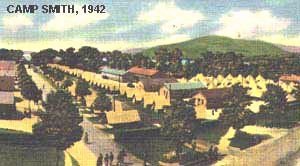
Description: Camp Smith: 1882/5, Westchester County, Peekskill. New York Militia Camp. Original camp grounds acquired in 1885. Known as Camp Townsend in 1898 for the State's Adjutant General during the Spanish-American War mobilizations. Enlarged in 1913 and renamed for Governor Smith, 1914 and 1923 to its present size of nearly 2,000 acres.
[Description of third image]
Camp Smith
New York National Guard
Training camp estabalished
1882. Contains 1900 acres
named for Alfred E. Smith,
Governor of New York.
County: Westchester County
City, State: Peeksill, New York
Image:
See Also:
South Battery
Full History >>
Description: South Battery: 1810, New York City Harbor defenses. At foot of Bridge Street, foot of Manhattan, probably east of Castle Clinton which was known as South West Battery. This would be Battery Park or what in 1776 was known as the Grand Battery below Fort George.
South Battery (2): 1812, Kings County, Governor's Island. Built to guard Buttermilk Channel between Island and Brooklyn in 1812. On southern tip prior to island's expansion with fill from Brooklyn Tunnel. Later used as an Officer's Club.
County: 1) New York County, 2) Kings County
City, State: 1) New York City, New York, 2) Governor's Island, New York
South Redoubt
Full History >>
Description: South Redoubt: 1778, Putnam County, Village of Garrison, American. As part of the enlarged defenses of West Point two redoubts (North and South) were built two miles southeast of Constitution Island in the highlands enroute to Continental Village. Constructed on two sides of a hill now known as Fort Hill between the Village of Garrison and US Route 9.
County: Putnam County
City, State: Garrison, New York
See Also:
Southampton Old Fort
Full History >>
Description: Town of Southampton Old Fort: 1777-8, Suffolk County. Site of British fort during occupation.
County: Suffolk County
City, State: Southampton, New York
Branch:
Sow (Oquaga), Battery Old
Full History >>
Description: Battery Old Sow (Oquaga): 1812-14, Erie County, Buffalo. Near present City Water Plant, earthwork with one 8 inch Mortar. To the North was Fort Tompkins, and to the South was the Gookins Battery.
County: Erie County
City, State: Buffalo, New York
See Also:
Speed Blockhouse
Full History >>
Description: Speed Blockhouse: 1806, Tompkins County, Town of Caroline (Speedsville). On NY Route 79 - 1 and 1/2 mile west of town.
County: Tompkins County
City, State: Caroline (Speedsville), New York
Branch:
Spiral Fort
Full History >>
Description: Spiral Fort: : 1776, Kings County, Brooklyn. See Fort Corkscrew.
County: Kings County
City, State: Brooklyn, New York
See Also:
Spring Valley (NY-99) Nike Base
Full History >>
Description: Spring Valley (NY-99) Nike Base: 1956-63, Integrated Fire Control Area Nike-Ajax Missiles, launcher area was Ramapo. Inactivated 1963. Site owned by East Ramapo School District and is partially intact.
For more information see alpha.fdu.edu/~bender/NY99.html (link opens new window)
County: Rockland County
City, State: Spring Valley, New York
See Also:
St. Anne, Fort
Full History >>
Description: Fort St. Anne: 1667, Isle La Motta, Lake Champlain, Vermont. French fort.
For more information see www.historiclakes.org/explore/Exploring.html#FORT STE. ANNE (link opens new window)
County: Grand Isle County
City, State: Isle La Motte, Vermont
St. Croix, Fort
Full History >>
Description: Fort St.Croix (1): 1620s, Rensselaer County, West of Town of North Hoosick. Dutch stockade with cannon on North east bank of the Hoosick River. Destroyed some years later.
Fort St. Croix (2): 1750s, Rensselaer County. Built to protect Dutch settlement and guard Houstatonic Valley during French and Indian War.
County: Rensselaer County
City, State: North Hoosick, New York
St. George, Fort
Full History >>
Description: Fort St. George: 1777, Suffolk County, Mastic, Smith's Point. British, 1777-1780, a triangular fort included existing manor houses in two corners and a fortification in the third. Served as British supply base, destroyed in Nov 1780 raid.
County: Suffolk County
City, State: Mastic, New York
St. Theresa, Fort
Full History >>
Description: Fort St. Theresa: 1665, Richelieu River, Quebec, Canada. French fort at head of rapids near Lake Champlain.
County: Quebec County
City, State: Richelieu River, Quebec, Canada
Stanwix, Fort
Full History >>
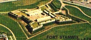
Description: Fort Stanwix: 1758, Oneida County, Rome. Built in summer 1758 to guard a strategic portage along a major transportation route. Fort Stanwix guarded the centuries old Oneida Carrying Place. This strategic Iroquois Confederacy portage in upstate New York bridged the waterways between the Atlantic Ocean (Hudson - Mohawk) and the Great Lakes (Wood Cr - Oneida Lk, Oswego R.). After the British conquered Canada in 1760 it gradually ceased to be a military post. During the American Revolution (then also known as Fort Schuyler), the Americans rebuilt the ruined fort in the summer of 1776. British military forces were repulsed while attempting to besiege the fort. In this battle of 3 Aug 1777 it is claimed that the Stars and Stripes first flew in the face of the enemy. American militia and Oneida allies tried to come to the aid of Fort Stanwix, but were cut off in an ambush at Oriskany, considered one of the bloodiest engagements of the war. Both these battles were part of St Leger's attempt towards Albany to meet up with Gen Burgoyne who was defeated at Saratoga. In 1781 the fort was virtually destroyed by fire and flood and substantially rebuilt and its original name restored. During the War of 1812 it was seriously neglected and a blockhouse was built as an emergency on the parade ground. Beginning in 1828 the fortifications were gradually dismantled. From 1970 to 1977 the National Park Service reconstructed the fort.
County: Oneida County
City, State: Rome, New York
Image:
See Also:
Related Links:
Star Redoubt
Full History >>
Description: Star Redoubt: 1776, New York City, See Lispenard's Redoubt.
County: New York County
City, State: New York City, New York
See Also:
Stark, Fort
Full History >>
Description: Fort Stark: 1812-15, Jefferson County, Sackets Harbor. A minor redoubt in a fortified line of 4 such "forts" (Kentucky, Virginia, Chauncey, Stark) anchored at Fort Pike on the Bay (later Madison Barracks) protecting the land side of Sackets Harbor.
County: Jefferson County
City, State: Sackets Harbor, New York
Ste. Frederic, Fort
Full History >>
Description: Fort Ste. Frederic (at Crown Point): 1734/37- 1759, Essex County, Crown Point. Fortifications were started by the French in 1734. Until 1759 Ft. Ste. Frederic was the seat of French power on Lake Champlain. The French destroyed the Redoute of the fort in 1759 before the advancing British. The British occupied the remaining buildings as a Hospital until the construction of Fort Crown Point was completed. Foundations remain, open to public.
County: Essex County
City, State: Crown Point, New York
See Also:
Ste. Marie Degannentaha
Full History >>
Description: Fort Ste. Marie Degannentaha: 1656, Onondaga County, Onondaga Lake, Syracuse. Constructed in 1656 to protect a French settlement, abandoned about 1658. Current reconstruction based on original Jesuit plans of the French Fort and Stockade.
County: Onondaga County
City, State: Syracuse, Onondaga Lake, New York
Sterling, Fort
Full History >>
Description: Fort Sterling: March 1776, Kings County, Brooklyn. The first American fort built in Brooklyn, it was located on a bluff at the very edge of the Brooklyn Heights. The site today is Columbia Steet between Clark and Orange Streets. Also known as Fort Half-Moon because of its open back. The fort was designed to command the East River. Taken by the British in August 1776 it was continuously garrisoned until their evacuation in 1783. This site was not used again. Another fort referred to as a grand citadel to be called The Congress was to have been constructed to the rear on higher ground at Henry and Pierrepoint Streets but was not started, but was where the British later built Fort Brooklyn.
County: Kings County
City, State: Brooklyn, New York
See Also:
Stevens, Fort
Full History >>
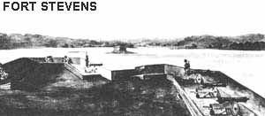
Description: Fort Stevens: Constructed on Hallett's Point, Queens, East River, 1814. Included a blockhouse on Mill Rock in the River at Hell Gate. Plans from Feb 1776 showed forts on both sides of the East River. Opposite here was Horn's Hook Battery. These fortifications may have dated from 1776.
County: Queens County
City, State: Queens, New York City, New York
Image:
See Also:
Stewart Air Force Base
Full History >>
Description: Stewart Air Force Base: 1940s, Orange County, Newburgh. Stewart International Airport is located almost entirely in the Town of New Windsor, Orange County, New York. The "Stewart Newburgh" designation used by the airlines is that the Stewart family gave the land to the City of Newburgh for a city airport in the 1930's. Stewart is named after Capt. Lachlan Stewart, who skippered schooners and other sailing vessels about 1850-1870. During World War II the City of Newburgh turned the airport over to the United States Government for the purposes of training West Point cadets to fly. The field grew and at the end of World War II it became Stewart Air Force Base. Stewart was used for North American Air Defense (Headquarters US Army Air Defense Command Region I) until 1972, when the Air Force determined that the base was excess, and deeded Stewart Air Force Base to the State of New York. See also SAGE for information on Air Defense Control Center, control for Suffolk BOMARCs. Now Stewart Army Sub Post of West Point, Stewart International Airport, and the New York Air National Guard has the largest C-5 Unit at Stewart. The Marine Corps also maintains a wing of C-130 aircraft at Stewart. The two military organizations occupy brand new state of the art military facilities. Stewart International Airport has 15,000 ft runway, the longest on the eastern seaboard.
County: Orange County
City, State: Newburgh, New York
Related Links:
Stillwater Blockhouse
Full History >>
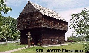
Description: Stillwater Blockhouse: 1777 era, Stillwater, Saratoga Co. The Stillwater Blockhouse is historically unique. It was built in part with timbers from Revolutionary era structures on the Neilsen Farm which stood within what is now Saratoga National Historical Park and was part of the Bemis Heights fortifications. It replicates the early 18th Century blockhouses of the region, but was actually built in 1927 as NYS turned the Saratoga Battlefield into an historical park. The "Battlefield blockhouse" was used as a visitor center and museum. Later when a new visitors center was constructed by the NPS, and as the structure was not authentic to the battlefield, it was donated in 1975 to the Town of Stillwater. It has been placed in a small park on the Hudson River, and is dedicated to local history.
In Colonial times historic forts and blockhouses existed on nearby sites (1701 Ft Ingoldsby, 1756 Ft Winslow, 1758 Montresor's Blockhouse).
County: Saratoga County
City, State: Stillwater, New York
Image:
Stony Point
Full History >>
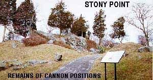
Description: Stony Point: 1779, Rockland County, Stony Point. Fortifications and Battlefield. "Gibralter of the Hudson" The British had captured the peninsula of Stony Point , and a small American Blockhouse, in May 1779, and began to fortify it by cutting down trees, and by erecting an earthen fort and two barriers called abatis. In addition, two British ships offered extra protection, and the newly-captured fort at Verplanck's Point (Fort Lafayette (1)), across the river, could be signaled by rocket for reinforcements. The commander of the garrison at Stony Point felt certain that his defenses were secure, calling the new fort his "little Gibraltar." Washington responded to Clinton's move by moving his troops to protect the American fortifications at West Point. On July 15, 1779, Wayne's troops began their march from Fort Montgomery, near the present-day Bear Mountain Bridge. Two columns swept up the treeless slopes, and a third went up the cliffs, arriving in the fort within minutes of each other. The heaviest fighting lasted half an hour, and by 1AM the garrison had surrendered. Three days later, Washington abandoned Stony Point because he knew it could not be defended against the combined might of the British army and navy. Although the British returned to Stony Point and rebuilt the fort, British troops were withdrawn in October because of insufficient reinforcements, and never again threatened the Hudson Highlands. The victory at Stony Point was the last major battle in the north, and boosted American morale. Battlefield is a State Park.
County: Rockland County
City, State: Stony Point, New York
Image:
Stratton Air National Guard Base
Full History >>
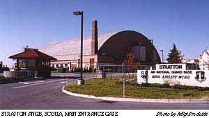
Description: Stratton Air National Guard Base: Schenectady County, Scotia. Need base history.
[Description of image]
Stratton ANGB, Scotia, Main Entrance Gate -- Photo by ??
County: Schenectady County
City, State: Scotia, New York
Branch:
Image:
Suffolk BOMARC Base
Full History >>
Description: Suffolk BOMARC Base: 1957, Suffolk County, Westhampton Beach. Site of 1st BOMARC Missile Interceptor Station. The BOMARC A was a Surface-to-Air Cruise Missile with a length of 45 feet, 3 inches and a wingspan of 18 feet, 2 inches. It's range was 230 miles. Following initial research and development activities after World War II, the pilotless interceptor aircraft or Surface-to-Air Missile (SAM) was envisioned as an instant readiness supersonic cruise aircraft with a range of several hundred miles. The SAM concept was created primarily to protect the U.S. mainland from enemy aircraft. By 1949, the first SAM designs were presented to the U.S. Air Force for consideration. These included plans for the Bomarc. The first production vehicle became known as Bomarc A, while a more advanced version became known as the Bomarc B. see Niagara Falls BOMARC Base. Bomarc was the first weapons system to employ an active homing system. Interceptions were controlled by a Semi-Automatic Ground Environment (SAGE) system from Stewart AFB, see SAGE designed to alert and control the SAM toward its target. A Bomarc missile prototype was first test-flown on September 10, 1952. The operational version was ready for its first test flight by February, 1955. Boeing began delivering operational Bomarc missiles to the U.S. Air Force in 1957, with a total of 366 deployed by 1960 at bases which could house one or two 28-missile squadrons. Initially two 28 Missile Squadrons of Bomarc A deployment occurred at Suffolk Air Force Base, New York. Deactivated 1969.
See BOMARC for more information.
County: Suffolk County
City, State: Westhampton Beach, New York
Suffolk County Air Force Base
Full History >>
Description: Suffolk County Air Force Base: 1950, Suffolk County, Westhampton Beach. USAF Interceptor base, picking up air defense of Metropolitan NY from Mitchel Field until that mission was transferred to McGuire AFB, NJ. Then became 1st BOMARC Missle Interceptor Station.
County: Suffolk County
City, State: Westhampton Beach, New York
See Also:
Suffolk County Airport
Full History >>
Description: Suffolk County Airport: 1969, Suffolk County, Westhampton Beach. Now Gabreski Airport and the Westhampton Beach Air National Guard Base.
County: Suffolk County
City, State: Westhampton Beach, New York
Sullivan, Fort
Full History >>
Description: Fort Sullivan: 1779, Tioga. Built by Americans during the Clinton-Sullivan expedition against the Iroguois in 1779.
County: Tioga County
City, State: Tioga, New York
Sutherland, Fort
Full History >>
Description: Fort Sutherland: 1778, Kings County, Brooklyn. British rename of Fort Greene (1776).
County: Kings County
City, State: Brooklyn, New York
See Also:
Swart's Fort
Full History >>
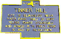
Description: Swart's Fort: 1776, Schenectady County, Three miles west of Scotia, at Tinker Hill. A blockhouse constructed by CPT Teunis Swart. Brick house surrounded by Palisade and armed with swivel Cannon piece. Revolutionary war period.
[Description of image]
Tinker Hill
Site of blockhouse near
river bank. Built by Capt.
teunis Swart. Stockaded
and armed with field piece
in war of Revolution.
County: Schenectady County
City, State: Scotia, New York
Image:
Swift, Fort
Full History >>
Description: Fort Swift: 1812, Kings County, Brooklyn. Built on site of former Fort Corkscrew (1776) by General Joseph G. Swift. Site bordered by Atlantic Avenue, Court, Pacific, and Clinton Streets.
County: Kings County
City, State: Brooklyn, New York
See Also:
Swift's Battery
Full History >>
Description: Swift's Battery: 1812-14, Erie County, Buffalo. One of a series of batteries on the Niagara River in Buffalo. Located North of Dudley's Battery that was just North of Ferry Street. No description of guns mounted. Further North at the mouth of the Conjaquadie's Creek was Sailor's Battery.
County: Erie County
City, State: Buffalo, New York
See Also: